NWS: “We continue to expect a few instances of localized gusty winds and marginal severe hail with the early evening scattered storms. Later storms coming in from the west northwest after 10 PM will have better shear, so gusty winds and maybe a QLCS spinup tornado cannot be ruled out as the storms approach. But the late storms will weaken considerably as they push into our area and especially toward I-65.”
Search Results for:
NWS: “We continue to expect a few instances of localized gusty winds and marginal severe hail with the early evening scattered storms. Later storms coming in from the west northwest after 10 PM will have better shear, so gusty winds and maybe a QLCS spinup tornado cannot be ruled out as the storms approach. But the late storms will weaken considerably as they push into our area and especially toward I-65.”
I-24 Special Possible Thursday Night, Low End Chance of Damaging Straight Line Winds.
Another very warm day is in store Thursday, high temperature expected to end up around 86°. Record high at BNA is 88°, could get close to at least tying.
Thursday evening into the overnight hours, a line of storms with heavy rain, lightning and gusty winds are expected drop down I-24, therefore nicknamed an “I-24 Special”, although it is debatable if they are actually special.
Storms likely Thursday night — Models think no storms today. The atmosphere would support severe weather today if storms could get going, but the last several runs show nothing happening.
But tomorrow/Thursday night a storm complex should drop down I-24 from Kentucky, aka an “I-24 Special.” These are usually dog stressors and noisemakers, with a lightning lottery.
Showers Wednesday AM, Capped Afternoon? More Rain Chances Thru Sunday
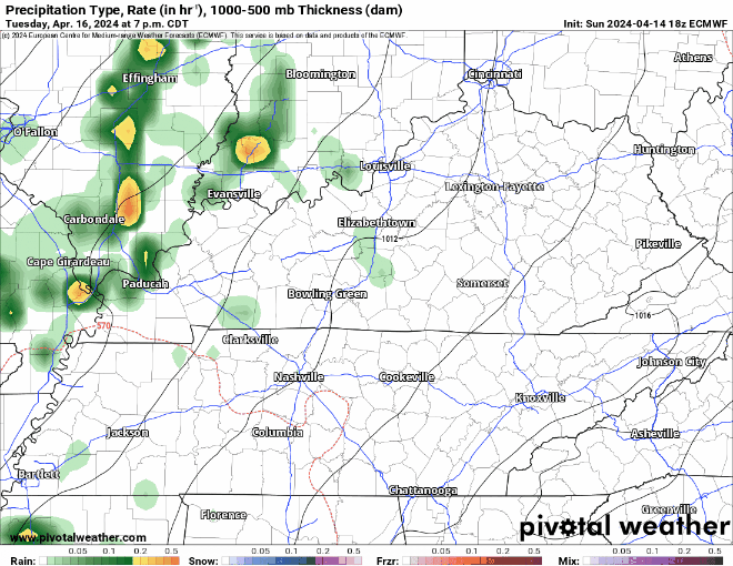
Storms incoming predawn/sunrise tomorrow (Weds) morning. Lightning and briefly heavy rain. Severe weather not expected. Storms lacking key ingredient: CAPE, which is near zero.
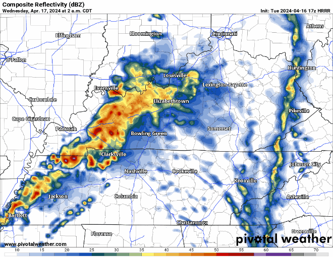
Weds afternoon/evening remains questionable. Previous models showed storms in place, with plenty of storm-making ingredients. While the tornado threat appears to be well north of us, the atmosphere could support heavy downpours, lightning, and low probability of damaging winds and hail. However, the last several model runs do not show any storm formation after the storms that will come through early in the morning.
Close to Record Highs Today + Tuesday, Conditional Low-End Severe Threat Wednesday.
Warm Week, Few Storm Chances Along The Way.
Monday looks like a great, dry spring-like day. High temperatures getting all the way into the mid 80s.
Tuesday still looks warm, but a few showers may swing around during the morning and evening hours.
There could be a few storms Tuesday night as a weakening line of storm approaches the area, but no severe concerns for our area.
That line of showers/storms should be moving out by rush hour Wednesday AM, but we could be dealing with more storm chances later in the day.
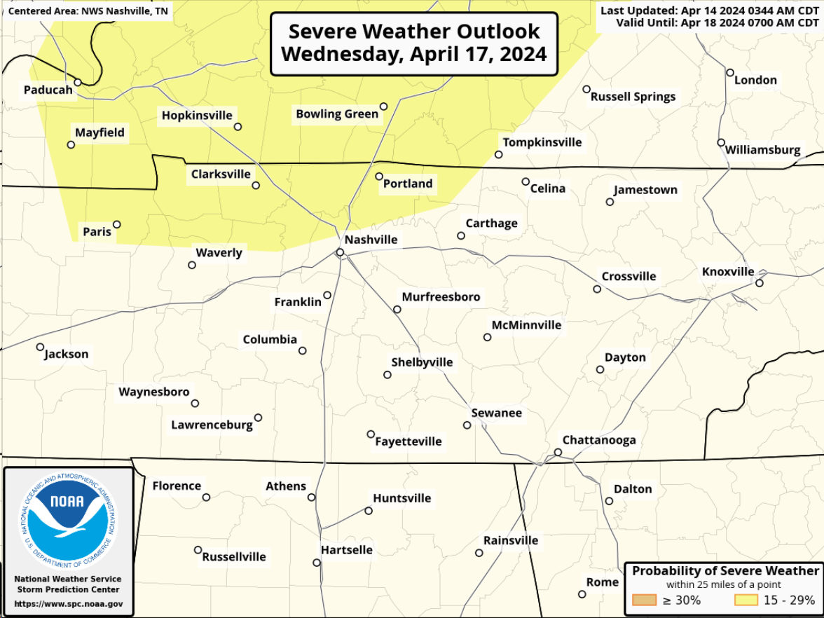
The Storm Prediction Center has included the far northern portion of Davidson Co. in a 15% chance of severe storms within 25 miles for Wednesday. This is still several days out, so a lot will change between now and then.
"Uncertainty continues on how strong or
widespread this activity may get as the upper level low weakens
while moving even further northward away from us, taking the main
upper forcing with it. Nevertheless, forecast soundings continue
to show quite favorable parameters for some strong to severe
thunderstorms ahead of the front, especially across our northwest
half, so we will have to keep a close eye on this potential." - NWS Nashville