


Today
A wet and cool afternoon is the story of the day here in Nashville. We are still watching the light rain traverse the area from west to east. High temperatures will struggle to reach 60º this afternoon with cloudy skies overhead. The rain will be exiting by midnight. Keep an umbrella handy through the day.
Cooler Temps and Rain Thursday/Friday
Low temperatures tomorrow morning are going to be around 40º, one of the cooler nights we have had this season.
We are going to watch moisture move in tomorrow afternoon from south to north ahead of our next cold front. Outdoor plans are not going to be the best idea by the evening hours as the rain will turn more steady.
Both major global models (EMCWF/GFS) are suggesting a very wet day on Friday. Do not plan on outdoor activities and keep an umbrella handy for Friday night football.
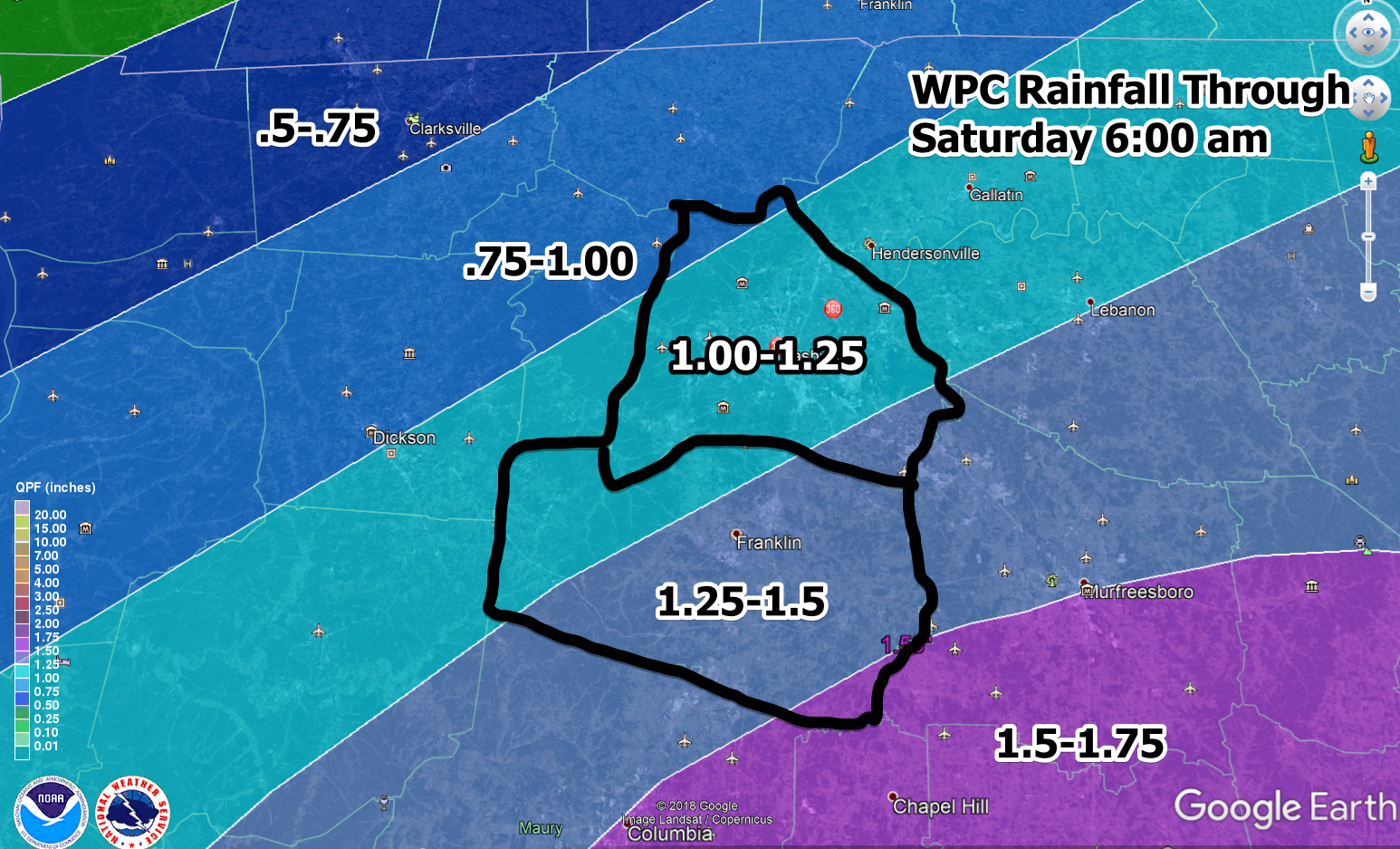
How much rain overall? The WPC has Nashville in the range for 1.0-1.5″ of rain through Saturday morning.
Once the rain clears out Friday into Saturday, watch for frost Saturday morning as temperatures flirt with freezing.
After the Rain
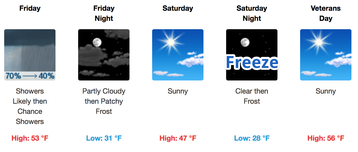 NWS Nashville: “High pressure will build in during the day [on Saturday], and even with mostly clear skies, expect afternoon highs to remain chilly in the 40s. Widespread frost is likely Sunday morning under clear skies and light/variable winds.”
Next Weather Maker
We will watch a low discharge from the Rocky Mountains on Monday that could make our weather a little more interesting. Here is more from NWS-Nashville.
The EURO/GFS are split on where this low will move, with the EURO much further west than the GFS. Nevertheless, ample moisture will send showers north Monday morning, continuing through Tuesday morning. Our forecast becomes slightly interesting Tuesday morning as a reinforcing shot of very cold air rushes in from the northwest. The temporal progress of this cold air is highly variable and uncertain at this time, but is important to the prospect of any frozen precipitation occuring Tuesday morning. It will also depend on if the precip hangs around long enough for the cold temperatures to arrive. For now, just have a mention of rain/snow for this period as it is still 6-7 days away. The main takeaway is that the stage is set for a period of below normal, winter-like temperatures through at least the middle part of next week.

We are watching!

 Log In To Facebook To Comment