


Light rain arrived mid-afternoon, on time, mostly south of I-40. From NWS-Nashville:
Expect most of the measurable rain to be south of I-40, with perhaps a hundredth or two falling in the Nashville area . . .
Rain should end before midnight. HRRR did well this morning, so here it is for tonight:
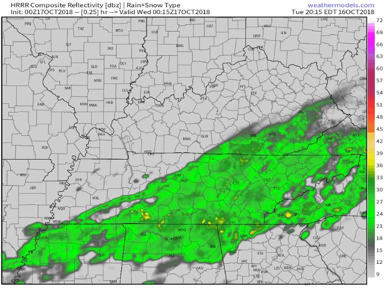
The NAM3 model agrees rain ends before midnight.
So nice when the models agree!

Nuisance rain with very little accumulating in your gauge.
Wednesday – Early Morning Frost?
Late today, high pressure will build in from north to south – which explains the end of rain chances late tonight or sometime Wednesday morning. Clouds clearing Wednesday, with high temps warming into the low 60s during the day.
Overnight calm winds without the heat trapping cloud blanket could let the temp dip into the upper 30°s in spots, especially low spots. Some of us may see a small early morning frost in low-lying areas and covered areas.
Thursday looks much the same with highs in the low 60°s, low temps in the upper 30°s. No precip expected.
Rain Returns Friday
Another round of rain showers will push through our area on Friday.
Thursday evening clouds will begin to crowd the sky, and by late Friday morning we could see a few sprinkles. The majority of rain will fall overnight Friday into the overnight hours Saturday, cutting off midday Saturday.
Friday night plans? Bring gear for a steady rain; no severe storms with this.
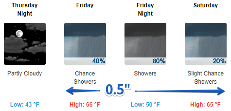
How much rain can we expect to see? It won’t be a total rain-out like we saw yesterday. This front will push through quickly: here late morning Friday, gone by mid afternoon on Saturday.
Rest of the weekend looks cooler but pretty nice.

 Log In To Facebook To Comment