


Still Talking About Florence
Here we are on Monday, September 17, still talking about a storm that formed on August 30. Just wow.
Florence will continue to be the major factor in our weather pattern. Its counter-clockwise flow and constant cloud cover are cooling our high temperatures by upwards of 10 degrees today. Looking at highs only the low 80s rather than the low 90s.
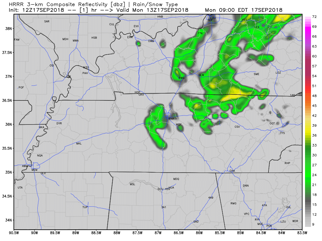
Off and on light rain is expected as what’s left of Florence passes to our east. This morning’s run of the HRRR model thinks rain is more likely this morning:
Florence Moves Out
Clouds will clear in the overnight hours making way for a major warm-up in Williamson and Davidson Counties. Humid, rainless, and hot will be the rule of thumb through Thursday.

A modest sized upper-level ridge (high pressure) will make way for high temperatures to rebound in the low to mid-90s. Note: This is 10+ degrees above average for this time of year.

Rain Chances Return
The dominant high pressure will push east by the time Friday rolls around. Its exit will lead to more of a summer-like pattern with the return of afternoon showers and storms on Friday and through the weekend.
We are watching next week for more rain as well. Here is more from NWS Nashville:
An upper level shortwave sweeps across the Great Lakes region as we head through the weekend, and tries to send a cold front southward to our area. However, we might need to wait for a second shortwave to roll out of the Mississippi Valley early next week before the front actually makes it down into the Ohio River and Tennessee Valleys and helps to enhance our rain chance.
Uncertainty remains, but we are watching.
For now, look for a typical hot and humid weekend, with hit-or-miss late afternoon/early evening showers and thunderstorms.
Looking Ahead
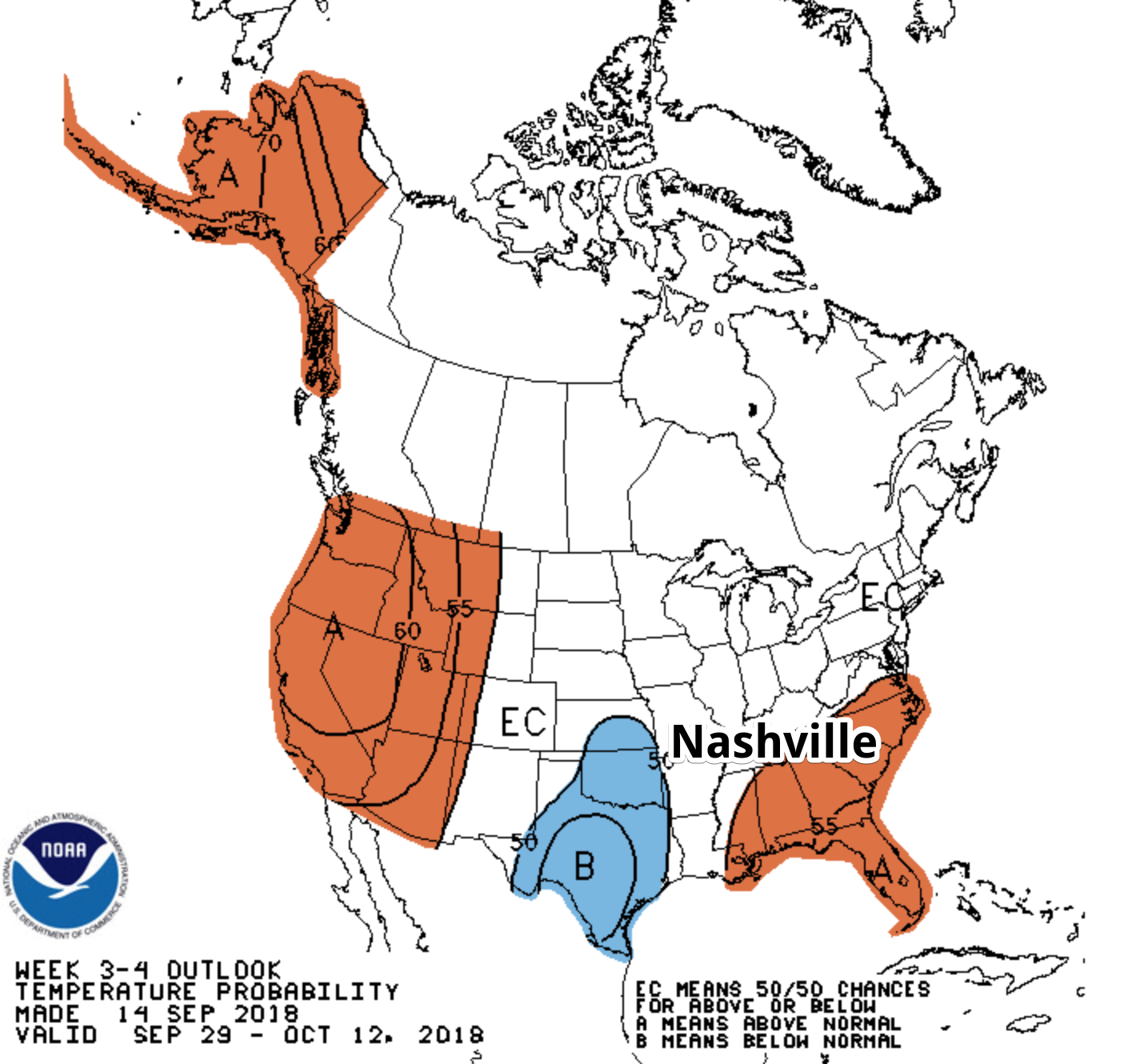
Don’t shoot the messenger, but it looks like temperatures are going to remain above average through at least the middle part of October. Fall is not in sight just yet.
Check back into NashSevereWx as we are constantly updating the forecast for Williamson and Davidson Counties.

 Log In To Facebook To Comment