


Thursday & Friday
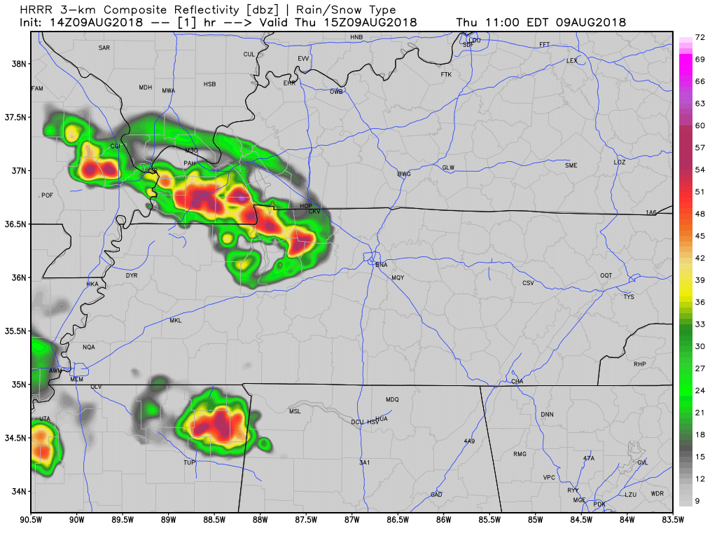
Showers and thunderstorms are expected today as the unsettled pattern continues and Nashville. The front that pushed through the area yesterday has stalled and giving us a chance of rain all day today. Here is more from NWS Nashville:
Today’s showers and thunderstorms will increase in coverage generally from southwest to northeast, with the greatest coverage mid to late afternoon. Locally heavy downpours will occur. A couple of storms could be strong with gusty winds, but hopefully with less wind damage than some storms had yesterday.
Afternoon highs are expected to reach the 80s in Williamson and Davidson Counties today. If thunderstorms evolve as expected, those highs will be reached around midday.
On Friday, showers and thunderstorms will increase in coverage again with the stalled front overhead. These showers and storms will move out Friday evening as the front moves to our east, allowing slightly drier air to drop in from the Ohio River Valley.
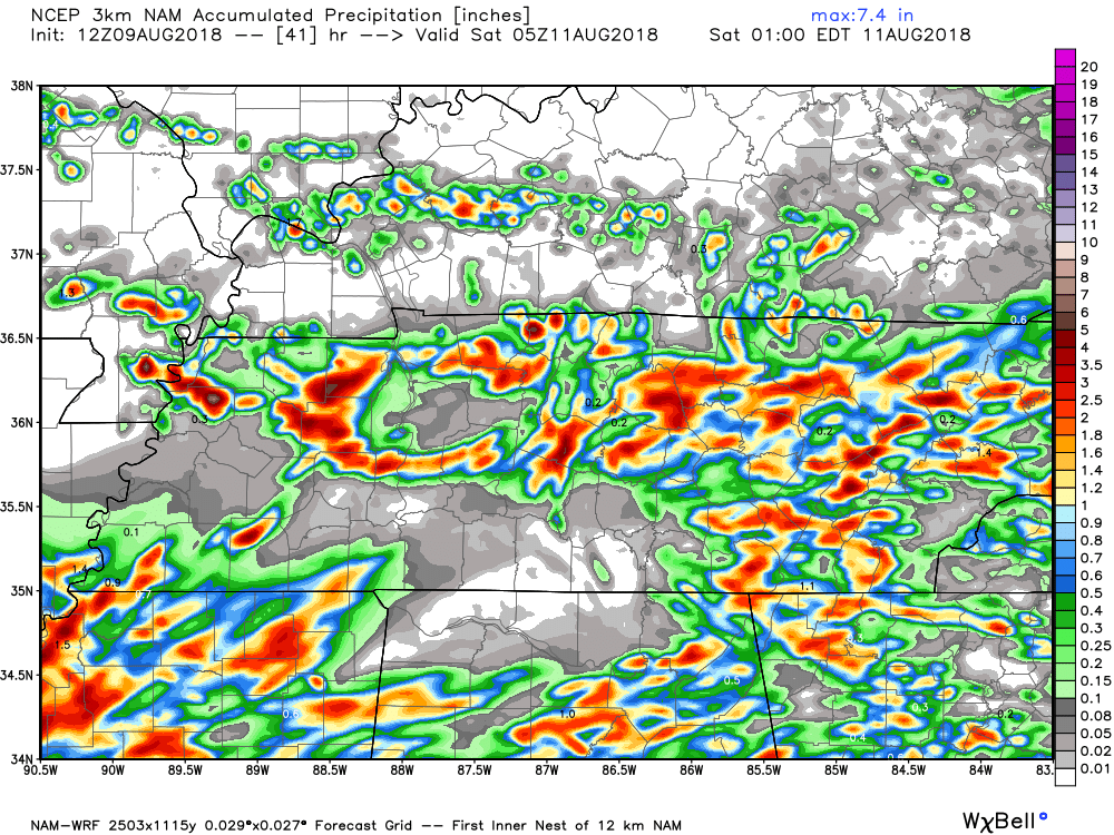
Rainfall totals today through Friday evening will be in the 1/2″ to 1″ range for many areas, but some spots will certainly pick up more from locally heavy downpours. Below is the NAM3 model prediction of total rainfall now through midnight Friday night:
This Weekend
Expect fog and low clouds Saturday morning. After that, partly to mostly sunny skies will allow temps to warm into the 80º range to around 90. There will be a slight chance for afternoon thunderstorms, not as much coverage area as expected today.
Sunday, we may begin to feel the impacts from a new rain-making system. A lot will have to happen to make this happen, so rain Sunday is rather uncertain. Just know that we are watching for rain Sunday afternoon and into the mid-week. Check back for updates.

 Log In To Facebook To Comment