Next Several Days: Cool & A Little Rainy

Scattered showers (hit and miss) will spread across Middle Tennessee tonight.

Low pressure wandering in the nation’s midsection will cloud us up, cool us off, and create a chance of rain every day this week. read more

Unsettled Weather, Below Normal Temps Next Several Days

Next Several Days

A low pressure center at 500 mb (that’s at 18,000 feet) will wander south from the Great Lakes, then spin around through the 4th of July. See the below (patriotic) loop from June 29 through July 7. The low pressure is red.  This will “unsettle” our weather through the 4th.

Our NWS says:

THIS DOESNT MEAN IT IS GOING 
TO RAIN EVERY MINUTE OF EVERY
HOUR BUT THERE WILL BE AN ON-
GOING CHANCE FOR SHOWERS AND 
A FEW THUNDERSTORMS ON A 
DAILY BASIS.

They continue:

EVEN AFTER UPPER LOW LIFTS NORTHWARD INTO CANADA AROUND JULY 4TH WE HAVE SUCH A GOOD MOISTURE FEED FROM THE GULF OF MEXICO INTO THE TENNESSEE VALLEY THANKS TO A RATHER STRONG BERMUDA HIGH KEEPING THE CHANCE OF SHOWERS AND THUNDERSTORMS. read more

Cool, Pleasant Weekend; Rain Possible Sunday

Today – High 86

A cold front has pushed through, ushering in cooler, drier air from the north. Aaaahhhh, sweet, wonderful relief.

Less humidity, with only a very slight chance of afternoon thunderstorms.  Any storms that  develop will be on the weaker side of things. Nothing to worry about. read more

One More Hot Day; Unseasonably Cool Temps Arrive This Weekend

Today – High 90, Maybe a Thunderstorm or Two

The MCS (Mesoscale Convective System, or large thunderstorm cluster) we were concerned about last night has missed us completely. It arrived this morning in Memphis on its way into Mississippi and Alabama. It produced a cool shelf cloud: read more

Stormy Friday Morning Possible; Better Weekend!

Today – High 95 

It’s been quite humid, with heat indices reaching 100 today.  You can all feel it in the air, and that is going to be the energy/fuel big storms tomorrow will be using — if they reach us tomorrow morning. read more

Update on Tonight’s Damaging Wind/Hail/Tornado Threat. Midnight ETA

The 8 p.m. update from the Storm Prediction Center has arrived. They’ve put us within the following probabilities of “x” happening within 25 miles of you tonight:

Damaging Winds (58 mph or more): 30%. Notice we’re in the bullseye. read more

Afternoon Update: Details on Tonight’s Wind/Hail/Tornado Risk

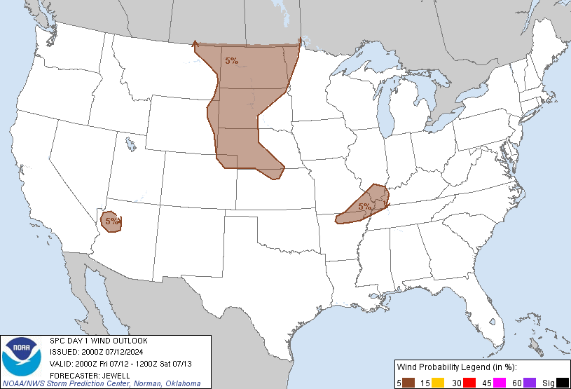
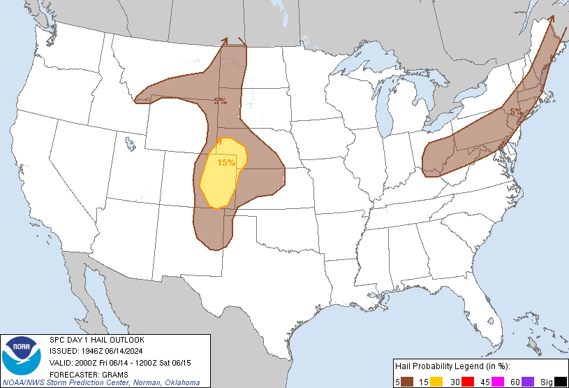
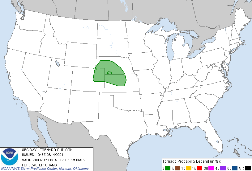
The 3 p.m. update from the Storm Prediction Center was largely unchanged for us. The probabilities of “x” happening within 25 miles of you today:

  • Damaging Winds (58mph+): 30%

  • Large Hail (1″+): 15%

  • Tornado: 2%:

Afternoon thunderstorms (previously advertised as “Round 1”) haven’t developed as predicted by weather models, likely due to a “cap” up in the atmosphere preventing a large amount of thunderstorm energy from being released. Also limiting afternoon thunderstorms has been some “mixing,” causing drier dewpoints to come on down . . . read more

Lunchtime Severe Weather Update - Wind/Hail/Tornado

The lunchtime outlook from the Storm Prediction Center says a mesoscale convective system (“MCS” – a bunch of thunderstorms moving together) “is expected to propagate southeastward into/through the central/southern Appalachians and Tennessee Valley by late evening.”  That’s us! read more

Details on Today’s Severe Weather Threat: Wind/Hail/Tornado

Today we’ll feel high humidity and temps topping out in the low 90s, but the main concern is the possibility of severe weather this afternoon and tonight.

Before I dive into the weather models, remember: weather models are useful tools for guidance. They are not Gospel. They are often off by hours, or “wrong” altogether. read more

Severe Weather Possible Wednesday

This Afternoon & Tonight – Still Might Storm

We’ve already hit 90 today. We may hit 91. Keep in mind all these temps are measured in the shade.

The dew point has remained around a miserable 70. Heat indices should approach 95. read more